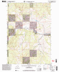
2000 Map of Lincoln Mountain
USGS Topo · Published 2005About this map
Nine Quarter Circle Ranch stands as a notable human footprint in this high-elevation wilderness, situated along the drainage of Taylor Creek. The map documents a landscape defined by the intersection of the Gallatin National Forest and the Gallatin State Wildlife Management Area, also labeled as the Gswma. A remote Landing Strip near the ranch indicates the difficulty of overland access to this section of the Madison Range near the Madison and Gallatin County line.
Find a feature on this map
20 named features on this map. Tap any name to fly to it.
Don’t see what you’re looking for? This feature index may not catch every label — zoom into the map to look around manually.
Map Details
Editions of this 2000 Lincoln Mountain Map
This is the sole edition of this map. No revisions or reprints were ever made.
Other maps of this area

1888 · Three Forks
USGS Topo · 1:250,000

1894 · Three Forks
USGS Topo · 1:250,000

1895 · Three Forks
USGS Topo · 1:250,000

1947 · Bozeman
USGS Topo · 1:250,000

1948 · Bozeman
USGS Topo · 1:250,000

1950 · Hebgen Dam
USGS Topo · 1:62,500

1950 · Sphinx Mountain
USGS Topo · 1:62,500

1955 · Bozeman
USGS Topo · 1:250,000

1955 · Crown Butte
USGS Topo · 1:62,500

1955 · Ashton
USGS Topo · 1:250,000