
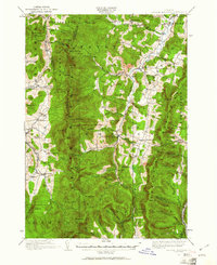
1919 Map of Lincoln Mountain
USGS Topo · Published 1953About this map
The Mad River valley serves as a central artery through this 1919 landscape, connecting the high ridges of the Green Mountains with the agricultural and industrial settlements of Waitsfield, Warren, and Moretown. Surveyed by Hersey Munroe and W.H.S. Morey, the map documents a decentralized educational system through numerous numbered and named district houses, such as Gove School and the South Olive School.
Find a feature on this map
114 named features on this map. Tap any name to fly to it.
Don’t see what you’re looking for? This feature index may not catch every label — zoom into the map to look around manually.
Map Details
Editions of this 1919 Lincoln Mountain Map
2 editions found
Other maps of this area

1902 · Brandon
USGS Topo · 1:62,500

1903 · Middlebury
USGS Topo · 1:62,500

1904 · Brandon
USGS Topo · 1:62,500

1905 · Middlebury
USGS Topo · 1:62,500

1906 · Burlington
USGS Topo · 1:62,500

1915 · Rochester
USGS Topo · 1:62,500

1917 · Rochester
USGS Topo · 1:62,500

1919 · Royalton
USGS Topo · 1:62,500

1919 · Burlington
USGS Topo · 1:62,500

1919 · Montpelier
USGS Topo · 1:62,500