
2020 Map of Lincoln Valley SW
USGS Topo · Published 2020About this map
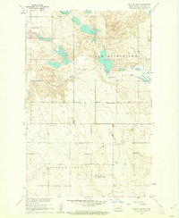
The N Country National Scenic Trail winds through this section of Sheridan County, crossing a landscape defined by an extensive network of small wetlands and prairie potholes. This rural landscape is partitioned by a strictly rectangular grid of section lines and roads, from 6th St NE in the south to 14th St NE at the northern boundary. Small, family-associated burial sites and former parish grounds offer significant value for genealogical research, including the Westheim Cem and the Hieb - Huft Cem. The northern edge of the map features the Evangelical United Brethren Cem, serving as a reminder of the religious congregations that once anchored these prairie townships during the early twentieth century.
Find a feature on this map
20 named features on this map. Tap any name to fly to it.
Don’t see what you’re looking for? This feature index may not catch every label — zoom into the map to look around manually.
Map Details
Editions of this 2020 Lincoln Valley SW Map
This is the sole edition of this map. No revisions or reprints were ever made.
Other maps of this area

1945 · Pelican Lake
USGS Topo · 1:62,500

1947 · Pelican Lake
USGS Topo · 1:62,500

1947 · Lincoln Valley
USGS Topo · 1:62,500

1954 · McClusky
USGS Topo · 1:250,000

1958 · McClusky
USGS Topo · 1:250,000

1959 · Pickardville
USGS Topo · 1:24,000

1959 · McClusky
USGS Topo · 1:24,000

1960 · Lincoln Valley SE
USGS Topo · 1:24,000

1960 · Denhoff
USGS Topo · 1:24,000
1960 · Lincoln Valley
USGS Topo · 1:24,000