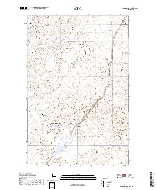
2024 Map of Lincoln Valley SW
USGS Topo · Published 2024About this map
Glacial prairie potholes and protected wetlands dominate this portion of Sheridan County, where the Sheridan County Waterfowl Production Area preserves a critical migratory landscape. The topography is defined by small, scattered water bodies and a grid of rural sections, bisected by the winding route of the North Country National Scenic Trl. This trail provides a unique crossing through the central and southern portions of the map, following the natural contours of the land. Small community burial sites like the Evangelical United Brethren Cem, Westheim Cem, and Hieb-Huft Cem are the primary cultural markers in this sparsely settled region, suggesting the locations of early rural congregations. The area is gridded by a series of numbered roads, from 14th St NE in the north down to 6th St NE, showing the organized layout of North Dakota's agricultural heartland.
Find a feature on this map
22 named features on this map. Tap any name to fly to it.
Don’t see what you’re looking for? This feature index may not catch every label — zoom into the map to look around manually.
Map Details
Editions of this 2024 Lincoln Valley SW Map
This is the sole edition of this map. No revisions or reprints were ever made.
Other maps of this area

1945 · Pelican Lake
USGS Topo · 1:62,500

1947 · Pelican Lake
USGS Topo · 1:62,500

1947 · Lincoln Valley
USGS Topo · 1:62,500

1954 · McClusky
USGS Topo · 1:250,000

1958 · McClusky
USGS Topo · 1:250,000

1959 · Pickardville
USGS Topo · 1:24,000

1959 · McClusky
USGS Topo · 1:24,000

1960 · Lincoln Valley SE
USGS Topo · 1:24,000

1960 · Denhoff
USGS Topo · 1:24,000
1960 · Lincoln Valley
USGS Topo · 1:24,000