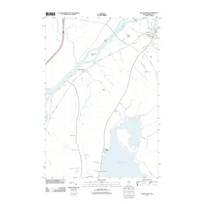
2011 Map of Lincoln West
USGS Topo · Published 2011About this map
The Penobscot River flows prominently through this section of Penobscot County, shaping the local geography around islands like Mink Island and Mahockanock Island. The town of Lincoln serves as a primary hub, situated where the Mattanawcook Stream meets Mill Pond, with water levels managed by the Mill Pond Dam and Mattanawcook Dam. This survey documents a landscape defined by the transition from riverfront industry and transit to lakeside recreation. To the south, Cold Stream Pond draws visitors to Morgan Beach and Lakeside Camping and Cabins, while the interior hills, such as Wilson Hill and Grays Hill, rise above the surrounding brooks. Researchers can find genealogical points of interest at the Ridge Cemetery and trace residential developments like Darling Ests and South Lincoln. The map also details essential infrastructure, including the Lincoln Regional Airport and the Lincoln Post Office.
Find a feature on this map
56 named features on this map. Tap any name to fly to it.
Don’t see what you’re looking for? This feature index may not catch every label — zoom into the map to look around manually.
Map Details
Editions of this 2011 Lincoln West Map
This is the sole edition of this map. No revisions or reprints were ever made.
Other maps of this area

1917 · Passadumkeag
USGS Topo · 1:62,500

1920 · Winn
USGS Topo · 1:62,500

1931 · Saponac
USGS Topo · 1:48,000

1934 · Saponac
USGS Topo · 1:62,500

1942 · Lincoln
USGS Topo · 1:62,500

1954 · Millinocket
USGS Topo · 1:250,000

1957 · Lincoln
USGS Topo · 1:62,500

1957 · Saponac
USGS Topo · 1:62,500

1958 · Millinocket
USGS Topo · 1:250,000

1960 · Millinocket
USGS Topo · 1:250,000