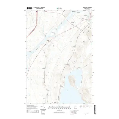
2014 Map of Lincoln West
USGS Topo · Published 2014About this map
The Penobscot River winds through this central Maine landscape, defining the character of Lincoln and its neighboring settlements. A series of large islands, including Mink Island, Mahockanock Island, and Mattanawcook Island, punctuate the river's path as it flows past Mohawk Rapids. To the east, the terrain rises toward Fish Hill and Wilson Hill, while the southeastern portion of the map is dominated by the expansive waters of Cold Stream Pond, featuring Morgan Beach. Local history is anchored by several burial grounds like West Broadway Cem and Park Street Cem, alongside the distinct geological formation of the Enfield Horseback. The presence of the Lincoln Regional Airport and a developed network of roads such as W Broadway and Enfield Rd show the modern connectivity of this river-and-lake corridor.
Find a feature on this map
66 named features on this map. Tap any name to fly to it.
Don’t see what you’re looking for? This feature index may not catch every label — zoom into the map to look around manually.
Map Details
Editions of this 2014 Lincoln West Map
This is the sole edition of this map. No revisions or reprints were ever made.
Other maps of this area

1917 · Passadumkeag
USGS Topo · 1:62,500

1920 · Winn
USGS Topo · 1:62,500

1931 · Saponac
USGS Topo · 1:48,000

1934 · Saponac
USGS Topo · 1:62,500

1942 · Lincoln
USGS Topo · 1:62,500

1954 · Millinocket
USGS Topo · 1:250,000

1957 · Lincoln
USGS Topo · 1:62,500

1957 · Saponac
USGS Topo · 1:62,500

1958 · Millinocket
USGS Topo · 1:250,000

1960 · Millinocket
USGS Topo · 1:250,000