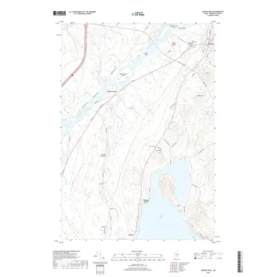
2018 Map of Lincoln West
USGS Topo · Published 2018About this map
Penobscot River geography defines this portion of Penobscot County, where the river's path is marked by islands such as Mahockanock Island and the turbulent Mohawk Rapids. The settlement pattern follows the river and the major thoroughfares of Rte 2 and W Broadway, connecting the main village of Lincoln with South Lincoln and Enfield to the south. Local history is anchored by several burial grounds, including the Park Street Cem and West Broadway Cem near the town center, and the more secluded Ridge Cem and Town Line Cem further inland.
Find a feature on this map
64 named features on this map. Tap any name to fly to it.
Don’t see what you’re looking for? This feature index may not catch every label — zoom into the map to look around manually.
Map Details
Editions of this 2018 Lincoln West Map
This is the sole edition of this map. No revisions or reprints were ever made.
Other maps of this area

1917 · Passadumkeag
USGS Topo · 1:62,500

1920 · Winn
USGS Topo · 1:62,500

1931 · Saponac
USGS Topo · 1:48,000

1934 · Saponac
USGS Topo · 1:62,500

1942 · Lincoln
USGS Topo · 1:62,500

1954 · Millinocket
USGS Topo · 1:250,000

1957 · Lincoln
USGS Topo · 1:62,500

1957 · Saponac
USGS Topo · 1:62,500

1958 · Millinocket
USGS Topo · 1:250,000

1960 · Millinocket
USGS Topo · 1:250,000