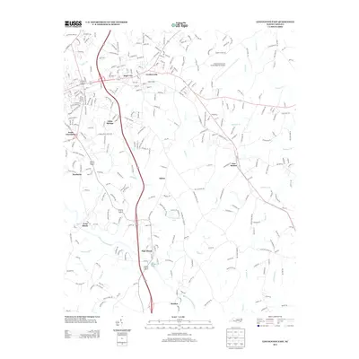
2013 Map of Lincolnton East
USGS Topo · Published 2013About this map
Goodsonville and Boger City anchor the northern reaches of this landscape, marking the eastward expansion of the Lincolnton area. The terrain is defined by the winding course of the S Fork Catawba River, which flows through the southern section near the communities of High Shoals and Hardins. This corridor reflects a history of small riverside settlements where water power once dictated the local economy, now transitioned into a residential and light industrial fabric.
Find a feature on this map
288 named features on this map. Tap any name to fly to it.
Don’t see what you’re looking for? This feature index may not catch every label — zoom into the map to look around manually.
Map Details
Editions of this 2013 Lincolnton East Map
This is the sole edition of this map. No revisions or reprints were ever made.
Other maps of this area

1895 · Hickory
USGS Topo · 1:125,000

1909 · Lincolnton
USGS Topo · 1:62,500

1911 · Lincolnton
USGS Topo · 1:62,500

1914 · Gastonia
USGS Topo · 1:48,000

1916 · Gastonia
USGS Topo · 1:62,500

1953 · Charlotte
USGS Topo · 1:250,000

1954 · Charlotte
USGS Topo · 1:250,000

1960 · Charlotte
USGS Topo · 1:250,000

1962 · Charlotte
USGS Topo · 1:250,000
1970 · Mount Holly
USGS Topo · 1:24,000