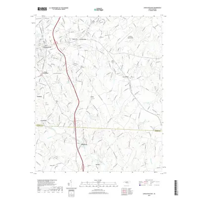
2019 Map of Lincolnton East
USGS Topo · Published 2019About this map
Lincolnton and its eastern suburbs form the core of this 2019 survey, where the transition from municipal center to Piedmont countryside is marked by a series of long-standing communities. Settlements like Boger City, Goodsonville, and South Lincolnton surround the urban heart, while the landscape further east is defined by creek drainage systems including Leepers Cr and Hoyle Cr. The southern portion of the map traces the South Fork Catawba River as it passes through Long Shoals and High Shoals near the boundary between Lincoln and Gaston Counties.
Find a feature on this map
226 named features on this map. Tap any name to fly to it.
Don’t see what you’re looking for? This feature index may not catch every label — zoom into the map to look around manually.
Map Details
Editions of this 2019 Lincolnton East Map
This is the sole edition of this map. No revisions or reprints were ever made.
Other maps of this area

1895 · Hickory
USGS Topo · 1:125,000

1909 · Lincolnton
USGS Topo · 1:62,500

1911 · Lincolnton
USGS Topo · 1:62,500

1914 · Gastonia
USGS Topo · 1:48,000

1916 · Gastonia
USGS Topo · 1:62,500

1953 · Charlotte
USGS Topo · 1:250,000

1954 · Charlotte
USGS Topo · 1:250,000

1960 · Charlotte
USGS Topo · 1:250,000

1962 · Charlotte
USGS Topo · 1:250,000
1970 · Mount Holly
USGS Topo · 1:24,000