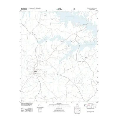
2011 Map of Lincolnton
USGS Topo · Published 2011About this map
Lincolnton serves as the focal point of this Georgia landscape, situated at the crossroads of numerous rural routes and home to the Lincolnton Cemetery. To the north and east, the jagged shoreline of the J. Strom Thurmond Reservoir dramatically reshapes the local geography, creating deep inlets where Curry Creek and Soap Creek meet the rising water. This 2011 survey captures the area's mix of recreational infrastructure and aviation, featuring the Elijah Clark State Park along the reservoir and a cluster of local airfields including the New Prater Ranch Airport and the Old Prater Ranch Airport.
Find a feature on this map
85 named features on this map. Tap any name to fly to it.
Don’t see what you’re looking for? This feature index may not catch every label — zoom into the map to look around manually.
Map Details
Editions of this 2011 Lincolnton Map
This is the sole edition of this map. No revisions or reprints were ever made.
Other maps of this area

1892 · Mc Cormick
USGS Topo · 1:125,000

1906 · Crawfordville
USGS Topo · 1:125,000

1912 · Mc Cormick
USGS Topo · 1:125,000

1921 · Appling
USGS Topo · 1:62,500

1943 · Appling
USGS Topo · 1:62,500

1953 · Athens
USGS Topo · 1:250,000

1954 · Metasville
USGS Topo · 1:24,000

1955 · Chennault
USGS Topo · 1:24,000

1958 · Athens
USGS Topo · 1:250,000

1959 · Athens
USGS Topo · 1:250,000