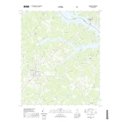
2020 Map of Lincolnton
USGS Topo · Published 2020About this map
Lincolnton serves as the focal point of this survey, anchored by the Lincoln County Courthouse and the nearby Lincoln County Cem. The landscape is dominated by the sprawling reach of the J. Strom Thurmond Reservoir, which defines the northern and eastern boundaries of the area. This massive water body is crossed by the Fortson Ferry Bridge at the border of the Sumter National Forest, illustrating the intersection of modern infrastructure and protected woodlands along the Georgia-South Carolina state line.
Find a feature on this map
91 named features on this map. Tap any name to fly to it.
Don’t see what you’re looking for? This feature index may not catch every label — zoom into the map to look around manually.
Map Details
Editions of this 2020 Lincolnton Map
This is the sole edition of this map. No revisions or reprints were ever made.
Other maps of this area

1892 · Mc Cormick
USGS Topo · 1:125,000

1906 · Crawfordville
USGS Topo · 1:125,000

1912 · Mc Cormick
USGS Topo · 1:125,000

1921 · Appling
USGS Topo · 1:62,500

1943 · Appling
USGS Topo · 1:62,500

1953 · Athens
USGS Topo · 1:250,000

1954 · Metasville
USGS Topo · 1:24,000

1955 · Chennault
USGS Topo · 1:24,000

1958 · Athens
USGS Topo · 1:250,000

1959 · Athens
USGS Topo · 1:250,000