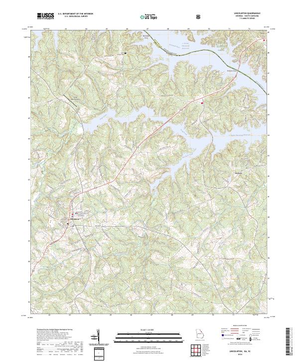
2024 Map of Lincolnton
USGS Topo · Published 2024About this map
The Georgia-South Carolina border is defined by the Savannah River J. Strom Thurmond Reservoir, where numerous inlets and creeks feed into this significant water system. The city of Lincolnton serves as a central hub, anchored by the Lincoln County Courthouse. The surrounding landscape is characterized by its agricultural and forested layout, including portions of the Sumter National Forest to the north. Historical sites and genealogy points are scattered throughout the region, such as the Lincoln Presbyterian Church Cem and the Smith Chapel Cem near the small settlement of Smith. Legacy river crossings are noted at Barksdale Ferry and Fortsons Ferry, while smaller communities like Leverett remain connected by a network of local roads. The map also captures specialized sites like the Prater Ranch Airport and natural features such as Dooley Spring and Soap Creek.
Find a feature on this map
100 named features on this map. Tap any name to fly to it.
Don’t see what you’re looking for? This feature index may not catch every label — zoom into the map to look around manually.
Map Details
Editions of this 2024 Lincolnton Map
This is the sole edition of this map. No revisions or reprints were ever made.
Other maps of this area

1892 · Mc Cormick
USGS Topo · 1:125,000

1906 · Crawfordville
USGS Topo · 1:125,000

1912 · Mc Cormick
USGS Topo · 1:125,000

1921 · Appling
USGS Topo · 1:62,500

1943 · Appling
USGS Topo · 1:62,500

1953 · Athens
USGS Topo · 1:250,000

1954 · Metasville
USGS Topo · 1:24,000

1955 · Chennault
USGS Topo · 1:24,000

1958 · Athens
USGS Topo · 1:250,000

1959 · Athens
USGS Topo · 1:250,000