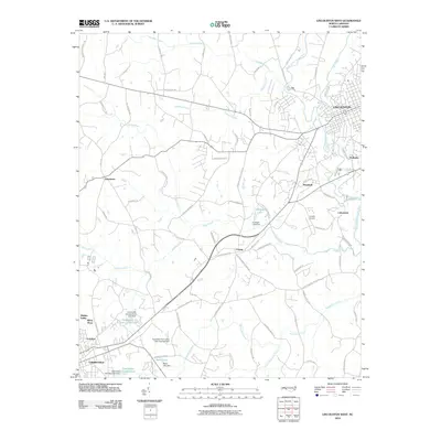
2010 Map of Lincolnton West
USGS Topo · Published 2010About this map
Lincolnton anchors the northeastern corner of this study, where the South Fork Catawba River winds south through a landscape transitioning between established industrial towns and rural communities. In the southwest, Cherryville is documented alongside its local infrastructure, including the Cherryville City Reservoir and Cherryville Country Club Lake. The mapping reveals a network of smaller named settlements like Crouse, Laboratory, and Polkadot, reflecting the historical growth of Lincoln County.
Find a feature on this map
86 named features on this map. Tap any name to fly to it.
Don’t see what you’re looking for? This feature index may not catch every label — zoom into the map to look around manually.
Map Details
Editions of this 2010 Lincolnton West Map
This is the sole edition of this map. No revisions or reprints were ever made.
Other maps of this area

1895 · Hickory
USGS Topo · 1:125,000

1909 · Lincolnton
USGS Topo · 1:62,500

1911 · Lincolnton
USGS Topo · 1:62,500

1914 · Gastonia
USGS Topo · 1:48,000

1916 · Gastonia
USGS Topo · 1:62,500

1953 · Charlotte
USGS Topo · 1:250,000

1954 · Charlotte
USGS Topo · 1:250,000

1960 · Charlotte
USGS Topo · 1:250,000

1962 · Charlotte
USGS Topo · 1:250,000
1970 · Banoak
USGS Topo · 1:24,000