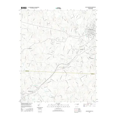
2016 Map of Lincolnton West
USGS Topo · Published 2016About this map
Lincolnton and its western outskirts are defined by the winding course of the South Fork Catawba River and the small agricultural communities that dot the Piedmont landscape. This 2016 survey highlights several historical burial grounds including the Old White Church Cem and the Old Methodist Church Cem, reflecting the early religious foundations of the area. To the south, the settlement of Laboratory sits near the river, while the town of Cherryville anchors the southwestern corner, featuring the Cherryville City Reservoir and Cherryville Country Club Lake.
Find a feature on this map
188 named features on this map. Tap any name to fly to it.
Don’t see what you’re looking for? This feature index may not catch every label — zoom into the map to look around manually.
Map Details
Editions of this 2016 Lincolnton West Map
This is the sole edition of this map. No revisions or reprints were ever made.
Other maps of this area

1895 · Hickory
USGS Topo · 1:125,000

1909 · Lincolnton
USGS Topo · 1:62,500

1911 · Lincolnton
USGS Topo · 1:62,500

1914 · Gastonia
USGS Topo · 1:48,000

1916 · Gastonia
USGS Topo · 1:62,500

1953 · Charlotte
USGS Topo · 1:250,000

1954 · Charlotte
USGS Topo · 1:250,000

1960 · Charlotte
USGS Topo · 1:250,000

1962 · Charlotte
USGS Topo · 1:250,000
1970 · Banoak
USGS Topo · 1:24,000