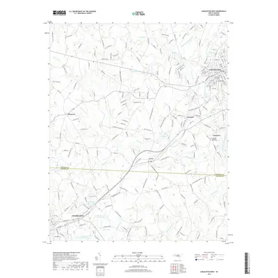
2019 Map of Lincolnton West
USGS Topo · Published 2019About this map
Lincolnton and Cherryville anchor this 2019 survey of the Piedmont landscape in Lincoln and Gaston counties. The area is defined by the winding course of the South Fork Catawba River and its numerous tributaries, including Indian Creek and Leonard Fork. These watercourses historically shaped the region's industrial and agricultural development, evident in named settlements like Laboratory and Crouse.
Find a feature on this map
194 named features on this map. Tap any name to fly to it.
Don’t see what you’re looking for? This feature index may not catch every label — zoom into the map to look around manually.
Map Details
Editions of this 2019 Lincolnton West Map
This is the sole edition of this map. No revisions or reprints were ever made.
Other maps of this area

1895 · Hickory
USGS Topo · 1:125,000

1909 · Lincolnton
USGS Topo · 1:62,500

1911 · Lincolnton
USGS Topo · 1:62,500

1914 · Gastonia
USGS Topo · 1:48,000

1916 · Gastonia
USGS Topo · 1:62,500

1953 · Charlotte
USGS Topo · 1:250,000

1954 · Charlotte
USGS Topo · 1:250,000

1960 · Charlotte
USGS Topo · 1:250,000

1962 · Charlotte
USGS Topo · 1:250,000
1970 · Banoak
USGS Topo · 1:24,000