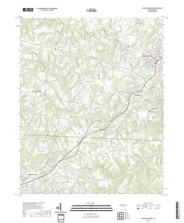
2022 Map of Lincolnton West
USGS Topo · Published 2022About this map
The Lincoln County Courthouse stands as the central landmark of Lincolnton, anchoring a landscape where the South Fork Catawba River and its numerous tributaries like Leonard Fork and Indian Creek define the geography. This modern survey reflects the historical layers of the region, specifically near the community of Laboratory, where the Laboratory Methodist Church Cem preserves local genealogy. The map area transition from the urban grid of Cherryville in the southwest to more dispersed settlements like Crouse and Johnstown.
Find a feature on this map
199 named features on this map. Tap any name to fly to it.
Don’t see what you’re looking for? This feature index may not catch every label — zoom into the map to look around manually.
Map Details
Editions of this 2022 Lincolnton West Map
This is the sole edition of this map. No revisions or reprints were ever made.
Other maps of this area

1895 · Hickory
USGS Topo · 1:125,000

1909 · Lincolnton
USGS Topo · 1:62,500

1911 · Lincolnton
USGS Topo · 1:62,500

1914 · Gastonia
USGS Topo · 1:48,000

1916 · Gastonia
USGS Topo · 1:62,500

1953 · Charlotte
USGS Topo · 1:250,000

1954 · Charlotte
USGS Topo · 1:250,000

1960 · Charlotte
USGS Topo · 1:250,000

1962 · Charlotte
USGS Topo · 1:250,000
1970 · Banoak
USGS Topo · 1:24,000