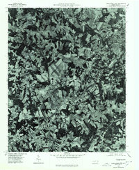
1976 Map of Lincolnton West
USGS Topo · Published 1978About this map
Lincolnton anchors the northeastern corner of this 1970s orthophotoquad, revealing the transition from its urban core to a sprawling agricultural and timber landscape. Produced from 1976 aerial photography, the imagery provides a photographic record of the terrain as it existed before decades of suburban expansion. The settlement of Laboratory sits to the south of the town center, while the smaller community of Crouse is positioned near the center of the sheet along a primary transportation corridor. In the western reaches, the map captures the outskirts of Cherryville and the hamlet of Johnstown. The distinctive orthophotographic format allows researchers to distinguish between cultivated fields, dense woodlots, and the fine-grained patterns of residential development and industrial sites that defined this part of Lincoln County during the mid-seventies.
Find a feature on this map
5 named features on this map. Tap any name to fly to it.
Don’t see what you’re looking for? This feature index may not catch every label — zoom into the map to look around manually.
Map Details
Editions of this 1976 Lincolnton West Map
This is the sole edition of this map. No revisions or reprints were ever made.
Other maps of this area

1895 · Hickory
USGS Topo · 1:125,000

1909 · Lincolnton
USGS Topo · 1:62,500

1911 · Lincolnton
USGS Topo · 1:62,500

1914 · Gastonia
USGS Topo · 1:48,000

1916 · Gastonia
USGS Topo · 1:62,500

1953 · Charlotte
USGS Topo · 1:250,000

1954 · Charlotte
USGS Topo · 1:250,000

1960 · Charlotte
USGS Topo · 1:250,000

1962 · Charlotte
USGS Topo · 1:250,000
1970 · Banoak
USGS Topo · 1:24,000