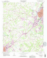
1993 Map of Lincolnton West
USGS Topo · Published 1996About this map
Lincolnton stands as the primary hub of this landscape, its urban grid and county Courthouse anchored near the banks of the South Fork Catawba River. In the early 1990s, this area reflects a mix of growing industrial sites and deep-rooted rural communities. The map highlights numerous local landmarks that define the region's social fabric, including Howards Creek Ch and Bethphage Ch, along with educational centers like Battleground Sch and Love Memorial Sch.
Find a feature on this map
55 named features on this map. Tap any name to fly to it.
Don’t see what you’re looking for? This feature index may not catch every label — zoom into the map to look around manually.
Map Details
Editions of this 1993 Lincolnton West Map
This is the sole edition of this map. No revisions or reprints were ever made.
Other maps of this area

1895 · Hickory
USGS Topo · 1:125,000

1909 · Lincolnton
USGS Topo · 1:62,500

1911 · Lincolnton
USGS Topo · 1:62,500

1914 · Gastonia
USGS Topo · 1:48,000

1916 · Gastonia
USGS Topo · 1:62,500

1953 · Charlotte
USGS Topo · 1:250,000

1954 · Charlotte
USGS Topo · 1:250,000

1960 · Charlotte
USGS Topo · 1:250,000

1962 · Charlotte
USGS Topo · 1:250,000
1970 · Banoak
USGS Topo · 1:24,000