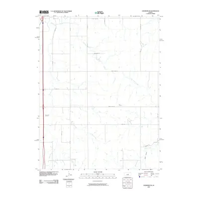
2009 Map of Lindsborg SE
USGS Topo · Published 2009About this map
Zion Cemetery and Smoky Hill Cemetery serve as historical anchors within this agricultural landscape in Saline County. The terrain is defined by a dense network of seasonal and permanent watercourses, including Kentucky Creek, Pewee Creek, and Stag Creek, which feed into the larger drainage systems of North Gypsum Creek and Gypsum Creek. The map reveals a highly structured rural grid of section-line roads, such as Smoky Valley Rd and Wheatridge Rd, indicating a well-established pattern of mid-continent farmsteads and land division. A notable geological feature, Black Canyon, cuts through the southeastern corner, contrasting with the relatively uniform topography found along Rose Hill Rd to the north. This survey provides a clear look at the intersection of natural hydrology and man-made infrastructure in the heart of Kansas.
Find a feature on this map
28 named features on this map. Tap any name to fly to it.
Don’t see what you’re looking for? This feature index may not catch every label — zoom into the map to look around manually.
Map Details
Editions of this 2009 Lindsborg SE Map
This is the sole edition of this map. No revisions or reprints were ever made.
Other maps of this area

1889 · Newton
USGS Topo · 1:125,000

1889 · Abilene
USGS Topo · 1:125,000

1891 · Hutchinson
USGS Topo · 1:125,000

1892 · Salina
USGS Topo · 1:125,000

1893 · Hutchinson
USGS Topo · 1:125,000

1894 · Newton
USGS Topo · 1:125,000

1894 · Abilene
USGS Topo · 1:125,000

1942 · Salina
USGS Topo · 1:125,000

1955 · Assaria
USGS Topo · 1:24,000

1955 · Smolan
USGS Topo · 1:24,000