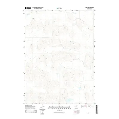
2014 Map of Linke Lake
USGS Topo · Published 2014About this map
Wenz Graves stands as a quiet point of historical interest in this sparsely populated region of Nebraska. The landscape is defined by its complex hydrology, featuring a cluster of wetlands including Armstrong Lake, the Chain Lakes, and the eponymous Linke Lake. These water bodies are situated amidst a network of drainage patterns, most notably the S Fork Elkhorn River and the meandering path of Dry Cr. The absence of dense road networks, with only 454th Ave providing significant access, suggests a land largely preserved for grazing or conservation. For the researcher, this 2014 survey captures the precise contours of the Sandhills ecosystem, where water sources like Cameron Lake dictate the movement of both wildlife and local commerce.
Find a feature on this map
8 named features on this map. Tap any name to fly to it.
Don’t see what you’re looking for? This feature index may not catch every label — zoom into the map to look around manually.
Map Details
Editions of this 2014 Linke Lake Map
This is the sole edition of this map. No revisions or reprints were ever made.
Other maps of this area

1954 · Bassett
USGS Topo · 1:24,000

1954 · Newport
USGS Topo · 1:24,000

1954 · Newport SW
USGS Topo · 1:24,000

1955 · O'Neill
USGS Topo · 1:250,000

1959 · O'Neill
USGS Topo · 1:250,000

1969 · O'Neill
USGS Topo · 1:250,000
1982 · Linke Lake
USGS Topo · 1:24,000

1982 · Hagan Lake NE
USGS Topo · 1:24,000

1982 · Stockdale Lake
USGS Topo · 1:24,000

1982 · Sybrant
USGS Topo · 1:24,000