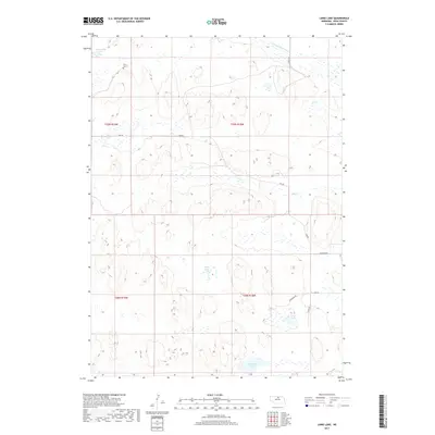
2017 Map of Linke Lake
USGS Topo · Published 2017About this map
Wenz Graves, located in the northwest corner of the township, stands as a solitary genealogical landmark in this remote section of the Nebraska Sandhills. The landscape is defined by its complex hydrology, where numerous ephemeral wetlands and larger permanent bodies of water like Linke Lake and Cameron Lake fill the low-lying basins between stabilized dunes. These lakes are part of a broader network of northern plains water features, including the Chain Lakes and the headwaters of the S Fork Elkhorn River.
Find a feature on this map
17 named features on this map. Tap any name to fly to it.
Don’t see what you’re looking for? This feature index may not catch every label — zoom into the map to look around manually.
Map Details
Editions of this 2017 Linke Lake Map
This is the sole edition of this map. No revisions or reprints were ever made.
Other maps of this area

1954 · Bassett
USGS Topo · 1:24,000

1954 · Newport
USGS Topo · 1:24,000

1954 · Newport SW
USGS Topo · 1:24,000

1955 · O'Neill
USGS Topo · 1:250,000

1959 · O'Neill
USGS Topo · 1:250,000

1969 · O'Neill
USGS Topo · 1:250,000
1982 · Linke Lake
USGS Topo · 1:24,000

1982 · Hagan Lake NE
USGS Topo · 1:24,000

1982 · Stockdale Lake
USGS Topo · 1:24,000

1982 · Sybrant
USGS Topo · 1:24,000