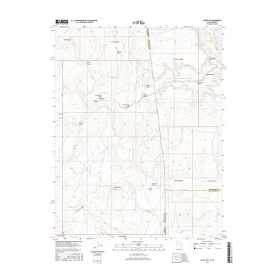
2017 Map of Lisbon Gap
USGS Topo · Published 2017About this map
Lisbon Gap serves as a prominent landmark in this high-desert landscape where the border of San Juan County, Utah, meets Montrose and San Miguel Counties in Colorado. The terrain is defined by a series of dramatic incisions and elevated plateaus, notably Mid Mesa and the expansive Island Mesa. This 2017 survey details a network of canyons that have shaped the region's geography and historical movement, including the narrow corridor of Lisbon Canyon and the evocatively named Horsethief Canyon.
Find a feature on this map
32 named features on this map. Tap any name to fly to it.
Don’t see what you’re looking for? This feature index may not catch every label — zoom into the map to look around manually.
Map Details
Editions of this 2017 Lisbon Gap Map
This is the sole edition of this map. No revisions or reprints were ever made.
Other maps of this area

1885 · La Sal
USGS Topo · 1:250,000

1916 · Paradox Valley
USGS Topo · 1:125,000

1922 · Paradox Valley
USGS Topo · 1:125,000

1948 · Horse Range Mesa
USGS Topo · 1:24,000

1948 · Paradox
USGS Topo · 1:24,000

1949 · Paradox
USGS Topo · 1:24,000
1949 · Anderson Mesa
USGS Topo · 1:24,000

1950 · Horse Range Mesa
USGS Topo · 1:24,000
1950 · Anderson Mesa
USGS Topo · 1:24,000

1954 · Mt Peale 1 SE
USGS Topo · 1:24,000