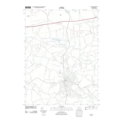
2010 Map of Lititz
USGS Topo · Published 2010About this map
Lititz serves as the focal point of this northern Lancaster County landscape, where the town's historic core is anchored by the Moravian Cemetery and the waters of Lititz Spring. The geography is defined by a dense network of local roads and waterways, including the winding Hammer Creek and its many tributaries like Santo Domingo Creek and Hubers Run. To the north, the terrain rises toward Eagle Rock and Cannon Hill, while the Cornwall Lookout Tower stands as a sentinel near the map's edge. This 2010 survey illustrates the developed character of the region, from the residential clusters of New Haven to the specialized infrastructure of Shenk Airport. Water management is prominent throughout the quadrangle, evidenced by the Speedwell Forge Dam and numerous small runs that have historically driven the local economy and agriculture of the Pennsylvania Dutch Country.
Find a feature on this map
92 named features on this map. Tap any name to fly to it.
Don’t see what you’re looking for? This feature index may not catch every label — zoom into the map to look around manually.
Map Details
Editions of this 2010 Lititz Map
This is the sole edition of this map. No revisions or reprints were ever made.
Other maps of this area

1891 · Lebanon
USGS Topo · 1:62,500

1893 · Lebanon
USGS Topo · 1:62,500

1899 · Lebanon
USGS Topo · 1:62,500

1902 · Wernersville
USGS Topo · 1:62,500

1902 · Lancaster
USGS Topo · 1:62,500

1904 · Lancaster
USGS Topo · 1:62,500

1906 · New Holland
USGS Topo · 1:62,500

1908 · New Holland
USGS Topo · 1:62,500

1941 · New Holland
USGS Topo · 1:62,500

1943 · Lancaster
USGS Topo · 1:62,500
Featured Places
- Lititz, PA
- Clay Township, PA
- Rothsville, Warwick Township
- Halfville, Warwick Township
- Limerock, Penn Township