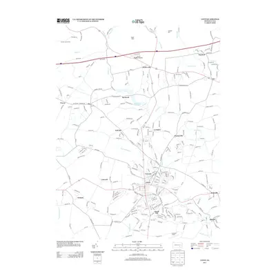
2013 Map of Lititz
USGS Topo · Published 2013About this map
The borough of Lititz serves as the focal point of this northern Lancaster County landscape, characterized by a dense network of roads radiating from the town center toward neighboring villages. The area’s historical hydrology is well-defined by the Lititz Spring and the southward flow of Lititz Run, while the northern hills are marked by the Cornwall Lookout Tower near Eagle Rock. A series of small settlements such as Brunnerville, Rothsville, and Brickerville illustrate the region's traditional Pennsylvania Dutch country settlement patterns, where small crossroads communities developed around local industry and agriculture.
Find a feature on this map
255 named features on this map. Tap any name to fly to it.
Don’t see what you’re looking for? This feature index may not catch every label — zoom into the map to look around manually.
Map Details
Editions of this 2013 Lititz Map
This is the sole edition of this map. No revisions or reprints were ever made.
Other maps of this area

1891 · Lebanon
USGS Topo · 1:62,500

1893 · Lebanon
USGS Topo · 1:62,500

1899 · Lebanon
USGS Topo · 1:62,500

1902 · Wernersville
USGS Topo · 1:62,500

1902 · Lancaster
USGS Topo · 1:62,500

1904 · Lancaster
USGS Topo · 1:62,500

1906 · New Holland
USGS Topo · 1:62,500

1908 · New Holland
USGS Topo · 1:62,500

1941 · New Holland
USGS Topo · 1:62,500

1943 · Lancaster
USGS Topo · 1:62,500
Featured Places
- Lititz, PA
- Clay Township, PA
- Rothsville, Warwick Township
- Halfville, Warwick Township
- Limerock, Penn Township