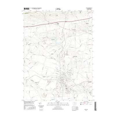
2016 Map of Lititz
USGS Topo · Published 2016About this map
Lititz anchors this portion of Lancaster County, shown at a time of significant suburban development south of the Furnace Hills. The map details the historic core of the town, including the Moravian Cem and Machpelah Cem, while tracing the expansion of residential clusters into Kissell Hill and Fairland. To the north, the landscape remains dominated by wooded ridges like Black Oak Ridge and Cannon Hill, where the Horseshoe Trl winds along the slopes. The area's industrial and agricultural history is visible through features like Erbs Quarry Rd and the scattered hamlets of Brunnerville, Penryn, and Hopeland. Waterways such as Hammer Creek and Lititz Run drainage patterns define the valley's layout, providing a clear view of the region's transition from rural farming tracts to a more densely populated landscape near Lancaster Airport.
Find a feature on this map
215 named features on this map. Tap any name to fly to it.
Don’t see what you’re looking for? This feature index may not catch every label — zoom into the map to look around manually.
Map Details
Editions of this 2016 Lititz Map
This is the sole edition of this map. No revisions or reprints were ever made.
Other maps of this area

1891 · Lebanon
USGS Topo · 1:62,500

1893 · Lebanon
USGS Topo · 1:62,500

1899 · Lebanon
USGS Topo · 1:62,500

1902 · Wernersville
USGS Topo · 1:62,500

1902 · Lancaster
USGS Topo · 1:62,500

1904 · Lancaster
USGS Topo · 1:62,500

1906 · New Holland
USGS Topo · 1:62,500

1908 · New Holland
USGS Topo · 1:62,500

1941 · New Holland
USGS Topo · 1:62,500

1943 · Lancaster
USGS Topo · 1:62,500
Featured Places
- Lititz, PA
- Clay Township, PA
- Rothsville, Warwick Township
- Halfville, Warwick Township
- Limerock, Penn Township