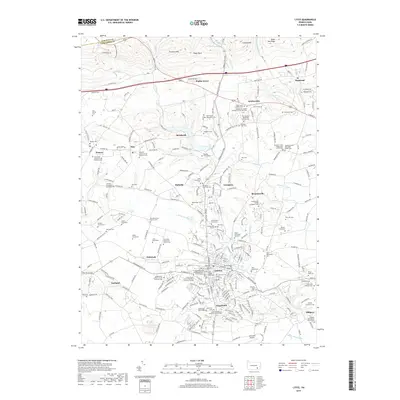
2019 Map of Lititz
USGS Topo · Published 2019About this map
Lititz and its surrounding borough landscapes showcase a dense concentration of religious and genealogical heritage in northern Lancaster County. The town core is anchored by historical sites like the Revolutionary War Memorial and the Lititz Church of the Brethren Memorial Garden. North of the settled center, the terrain rises into the Furnace Hills, where peaks such as Eagle Rock and Cannon Hill overlook a landscape marked by longstanding Mennonite and Amish communities. This pattern of settlement is reflected in the numerous family and denominational burial grounds, including the Hammer Creek Old Order Amish Cem and the Erb Mennonite Church Cem. Connectivity across this agricultural and residential region is defined by corridors like Lancaster Ave and the Horseshoe Trl, while the southern portion of the quadrangle accommodates modern infrastructure at the Lancaster Airport.
Find a feature on this map
94 named features on this map. Tap any name to fly to it.
Don’t see what you’re looking for? This feature index may not catch every label — zoom into the map to look around manually.
Map Details
Editions of this 2019 Lititz Map
This is the sole edition of this map. No revisions or reprints were ever made.
Other maps of this area

1891 · Lebanon
USGS Topo · 1:62,500

1893 · Lebanon
USGS Topo · 1:62,500

1899 · Lebanon
USGS Topo · 1:62,500

1902 · Wernersville
USGS Topo · 1:62,500

1902 · Lancaster
USGS Topo · 1:62,500

1904 · Lancaster
USGS Topo · 1:62,500

1906 · New Holland
USGS Topo · 1:62,500

1908 · New Holland
USGS Topo · 1:62,500

1941 · New Holland
USGS Topo · 1:62,500

1943 · Lancaster
USGS Topo · 1:62,500
Featured Places
- Lititz, PA
- Clay Township, PA
- Rothsville, Warwick Township
- Halfville, Warwick Township
- Limerock, Penn Township