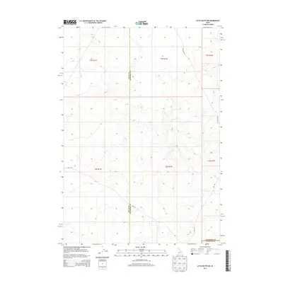
2013 Map of Little Butte NW
USGS Topo · Published 2013About this map
The intersection of Butte Co, Jefferson Co, and Bingham Co defines this corner of the Idaho desert. This topographic study reflects the high plains landscape where established roadways like Birch Creek Rd and Shell Rd navigate the open terrain of the Public Land Survey System. The map documents the precise township and range boundaries, including sections of t4n r32e and t5n r32e, illustrating the geometric order imposed on the Idaho wilderness. While the landscape is largely undeveloped, the placement of Ebr 2 Rd in the southeastern corner suggests localized access points within the Snake River Plain’s volcanic topography. The survey provides an essential spatial record for understanding county jurisdictions and land division in this rural Idaho region during the early twenty-first century.
Find a feature on this map
11 named features on this map. Tap any name to fly to it.
Don’t see what you’re looking for? This feature index may not catch every label — zoom into the map to look around manually.
Map Details
Editions of this 2013 Little Butte NW Map
This is the sole edition of this map. No revisions or reprints were ever made.
Other maps of this area

1955 · Idaho Falls
USGS Topo · 1:250,000

1958 · Idaho Falls
USGS Topo · 1:250,000

1969 · Antelope Butte
USGS Topo · 1:24,000

1969 · Circular Butte
USGS Topo · 1:24,000

1969 · Big Lost River Sinks
USGS Topo · 1:24,000

1973 · Little Butte NE
USGS Topo · 1:24,000

1973 · Little Butte NW
USGS Topo · 1:24,000

1973 · Circular Butte 3 NE
USGS Topo · 1:24,000

1973 · Circular Butte 3 SE
USGS Topo · 1:24,000

1973 · Little Butte SW
USGS Topo · 1:24,000