
1969 Map of Big Lost River Sinks
USGS Topo · Published 1973About this map
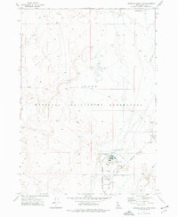
The National Reactor Testing Station dominates this landscape in Butte County, marking a period of intense federal investment in Idaho's desert. The terrain is characterized by the complex hydrology of the Big Lost River, which terminates in the Big Lost River Sinks, a series of depressions where surface water vanishes into the aquifer. A prominent Dry Channel and numerous depressions reflect the ephemeral nature of water in this high-altitude basin. Along the western edge, the foothills of the Lemhi Range rise sharply from the valley floor, providing a stark contrast to the flat, sandy expanses of Sand Dunes found further east. Transportation across this secure government facility is limited to thoroughfares like Lincoln Boulevard and several rugged routes marked as Jeep Trail, while several Borrow Pits indicate localized excavation for infrastructure development within the testing station boundaries.
Find a feature on this map
11 named features on this map. Tap any name to fly to it.
Don’t see what you’re looking for? This feature index may not catch every label — zoom into the map to look around manually.
Map Details
Editions of this 1969 Big Lost River Sinks Map
This is the sole edition of this map. No revisions or reprints were ever made.
Other maps of this area

1955 · Idaho Falls
USGS Topo · 1:250,000

1958 · Idaho Falls
USGS Topo · 1:250,000

1969 · Little Lost River Sinks
USGS Topo · 1:24,000

1969 · Circular Butte
USGS Topo · 1:24,000

1969 · Circular Butte NW
USGS Topo · 1:24,000

1969 · Richard Butte
USGS Topo · 1:24,000

1969 · Tyler Peak
USGS Topo · 1:24,000

1973 · Little Butte NW
USGS Topo · 1:24,000

1973 · Circular Butte 3 NE
USGS Topo · 1:24,000
1973 · Circular Butte 3 NW
USGS Topo · 1:24,000