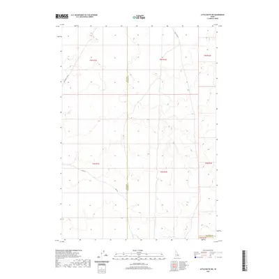
2020 Map of Little Butte NW
USGS Topo · Published 2020About this map
Birch Creek Rd and E Monument Line Rd frame this high-desert landscape in southeastern Idaho, where the borders of Butte, Jefferson, and Bingham counties converge. The terrain is defined by the Public Land Survey System, showing the transition between Township 5 North, Range 31 East and Township 4 North, Range 32 East. While contemporary in its mapping, the sheet documents the sparse network of remote desert tracks like Shell Rd that have long served as the primary transit routes across this corner of the Snake River Plain. This map provides a precise record of the administrative boundaries and rural infrastructure in a region where geography is dictated by township lines and volcanic topography.
Find a feature on this map
12 named features on this map. Tap any name to fly to it.
Don’t see what you’re looking for? This feature index may not catch every label — zoom into the map to look around manually.
Map Details
Editions of this 2020 Little Butte NW Map
This is the sole edition of this map. No revisions or reprints were ever made.
Other maps of this area

1955 · Idaho Falls
USGS Topo · 1:250,000

1958 · Idaho Falls
USGS Topo · 1:250,000

1969 · Antelope Butte
USGS Topo · 1:24,000

1969 · Circular Butte
USGS Topo · 1:24,000

1969 · Big Lost River Sinks
USGS Topo · 1:24,000

1973 · Little Butte NE
USGS Topo · 1:24,000

1973 · Little Butte NW
USGS Topo · 1:24,000

1973 · Circular Butte 3 NE
USGS Topo · 1:24,000

1973 · Circular Butte 3 SE
USGS Topo · 1:24,000

1973 · Little Butte SW
USGS Topo · 1:24,000