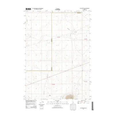
2013 Map of Little Butte SW
USGS Topo · Published 2013About this map
East Butte and the surrounding volcanic landscape of Twin Buttes define this corner of the eastern Idaho desert, mapped by the U.S. Geological Survey in 2013. This high-altitude terrain is marked by a network of utilitarian and historically significant thoroughfares, including the well-defined Stage Rd and the long stretches of Taylor Blvd and Harrison Blvd. The settlement of Argonne West appears in the northeast, while the boundary lines of Butte, Jefferson, and Bingham Counties converge across the open sagebrush and lava fields. Researchers will find the intersection of modern road infrastructure and geographic landforms, such as Twin Buttes Rd and Grant Rd, which trace the access points to these prominent desert landmarks and the surrounding agricultural or industrial frontier.
Find a feature on this map
16 named features on this map. Tap any name to fly to it.
Don’t see what you’re looking for? This feature index may not catch every label — zoom into the map to look around manually.
Map Details
Editions of this 2013 Little Butte SW Map
This is the sole edition of this map. No revisions or reprints were ever made.
Other maps of this area

1955 · Idaho Falls
USGS Topo · 1:250,000

1958 · Idaho Falls
USGS Topo · 1:250,000

1973 · Little Butte NE
USGS Topo · 1:24,000

1973 · Little Butte NW
USGS Topo · 1:24,000

1973 · Middle Butte
USGS Topo · 1:24,000

1973 · Circular Butte 3 NE
USGS Topo · 1:24,000

1973 · Atomic City
USGS Topo · 1:24,000

1973 · Circular Butte 3 SE
USGS Topo · 1:24,000

1973 · Little Butte SW
USGS Topo · 1:24,000

1973 · Little Butte
USGS Topo · 1:24,000