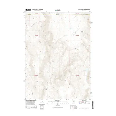
2015 Map of Little Coleman Canyon
USGS Topo · Published 2015About this map
Mosquito Mountain dominates this high-desert terrain where the borders of Oregon and Nevada meet. The landscape is defined by its drainage systems and water sources, including the catchment at Coleman Reservoir and the more southern Little Valley Reservoir. This 2015 survey illustrates a sparsely populated region of Washoe Co where local ranching and transit rely on a network of named tracks such as Barrel Springs Rd and Colman Ranch Rd. The geography transitions from the broad Mosquito Valley to the steep depressions of Little Coleman Canyon. Significant for its isolation, the area features essential water points like Glenco Spring, which historically supported movement through the canyon systems and along the seasonal Coleman Cr.
Find a feature on this map
21 named features on this map. Tap any name to fly to it.
Don’t see what you’re looking for? This feature index may not catch every label — zoom into the map to look around manually.
Map Details
Editions of this 2015 Little Coleman Canyon Map
This is the sole edition of this map. No revisions or reprints were ever made.
Other maps of this area

1889 · Long Valley
USGS Topo · 1:250,000

1954 · Vya
USGS Topo · 1:250,000

1955 · Adel
USGS Topo · 1:250,000

1957 · Adel
USGS Topo · 1:250,000

1958 · Vya
USGS Topo · 1:250,000

1958 · Adel
USGS Topo · 1:250,000

1962 · Vya
USGS Topo · 1:250,000

1962 · Adel
USGS Topo · 1:250,000
1966 · Barrel Springs
USGS Topo · 1:24,000
1966 · Mosquito Valley
USGS Topo · 1:24,000