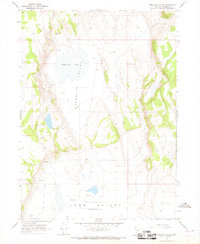
1966 Map of Mosquito Valley
USGS Topo · Published 1968About this map
Mosquito Lake sits at the heart of this high desert basin in northern Washoe County, a centerpiece of the broader Mosquito Valley landscape. The 1960s survey reveals a territory defined by its scarce water resources and ephemeral drainage, where naming conventions like Gravelly Spring and various unnamed Springs and Seeps denote the vital importance of surface water in an otherwise arid environment. To the south, the terrain drops into the Long Valley (Depression), a vast sink that collects runoff from the surrounding hills. Human presence is marked primarily by a network of primitive Jeep Trails and footpaths, suggesting a region used for cattle ranching or seasonal grazing rather than permanent settlement. The lack of structures or roads highlights the isolation of this corner of the Great Basin at the time of the field check.
Find a feature on this map
11 named features on this map. Tap any name to fly to it.
Don’t see what you’re looking for? This feature index may not catch every label — zoom into the map to look around manually.
Map Details
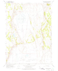
Editions of this 1966 Mosquito Valley Map
2 editions found
Other maps of this area

1889 · Long Valley
USGS Topo · 1:250,000

1954 · Vya
USGS Topo · 1:250,000

1958 · Vya
USGS Topo · 1:250,000

1962 · Vya
USGS Topo · 1:250,000
1966 · Barrel Springs
USGS Topo · 1:24,000

1966 · Massacre Lake NW
USGS Topo · 1:24,000
1966 · Little Coleman Canyon
USGS Topo · 1:24,000
1966 · Coleman Canyon
USGS Topo · 1:24,000
1966 · Calcutta Lake
USGS Topo · 1:24,000
1966 · Carter Reservoir
USGS Topo · 1:24,000