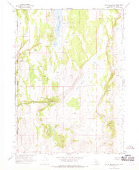
1966 Map of Carter Reservoir
USGS Topo · Published 1969About this map
Crooks Lake sits at the northern edge of this high-altitude basin, where the California Nevada border meets the line between Modoc and Washoe counties. The landscape is defined by its water sources, from the prominent Carter Reservoir and Mud Lake to numerous named points like Big Spring and Willow Springs. A single Grave is marked near the eastern shore of Crooks Lake, offering a poignant focal point for local historians and genealogists researching the remote families of this borderland.
Find a feature on this map
15 named features on this map. Tap any name to fly to it.
Don’t see what you’re looking for? This feature index may not catch every label — zoom into the map to look around manually.
Map Details
Editions of this 1966 Carter Reservoir Map
3 editions found
Other maps of this area

1886 · Alturas
USGS Topo · 1:250,000

1889 · Long Valley
USGS Topo · 1:250,000

1892 · Alturas
USGS Topo · 1:250,000

1954 · Vya
USGS Topo · 1:250,000

1954 · Alturas
USGS Topo · 1:250,000

1958 · Alturas
USGS Topo · 1:250,000

1958 · Vya
USGS Topo · 1:250,000

1962 · Alturas
USGS Topo · 1:250,000

1962 · Vya
USGS Topo · 1:250,000

1962 · Cedarville
USGS Topo · 1:62,500