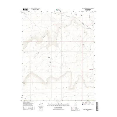
2017 Map of Little Creek Mountain
USGS Topo · Published 2017About this map
Apple Valley sits at the northern edge of this high-altitude landscape, where the plateau surface drops off toward the winding drainages of the Washington Co desert. The terrain is dominated by the prominent mass of Little Creek Mountain, an area defined by its network of modern recreational trails like the Magic Carpet and the W Loop. These trails navigate the rugged edge of the Uinkaret Plateau, reflecting the area's transition from a remote ranching and grazing territory into a destination for mountain biking and outdoor exploration. Water is a scarce and vital resource in this environment, marked by the locations of Gould Spring and seasonal watercourses such as Little Cr and Short Cr. In the central portion of the map, Abs Clearing stands as a rare break in the topography, while the eastern reaches are marked by the rising Gray Knoll near the residential development along N Apple Valley Dr.
Find a feature on this map
27 named features on this map. Tap any name to fly to it.
Don’t see what you’re looking for? This feature index may not catch every label — zoom into the map to look around manually.
Map Details
Editions of this 2017 Little Creek Mountain Map
This is the sole edition of this map. No revisions or reprints were ever made.
Other maps of this area

1885 · St. George
USGS Topo · 1:250,000

1886 · Mt. Trumbull
USGS Topo · 1:250,000

1891 · St. George
USGS Topo · 1:250,000

1892 · Mt. Trumbull
USGS Topo · 1:250,000

1953 · Cedar City
USGS Topo · 1:250,000

1953 · Grand Canyon
USGS Topo · 1:250,000

1954 · La Verkin 4 SE
USGS Topo · 1:24,000

1954 · La Verkin 4 NW
USGS Topo · 1:24,000

1954 · La Verkin 4 SW
USGS Topo · 1:24,000

1954 · Hurricane Cliffs 2 NE
USGS Topo · 1:24,000