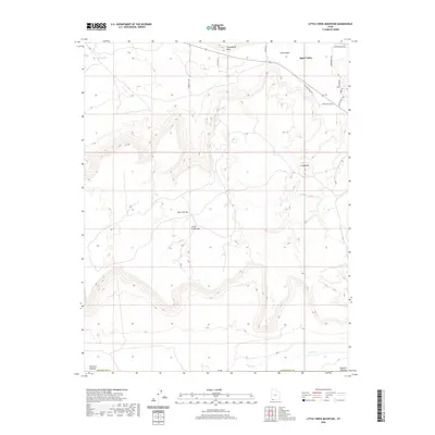
2020 Map of Little Creek Mountain
USGS Topo · Published 2020About this map
Apple Valley anchors the northeastern corner of this high-desert landscape, where residential street networks like North Apple Valley Road and West Smithsonian Way meet the rising elevations of the Colorado Plateau. The topography is defined by dramatic mesa edges and prominent landforms, notably the sprawling Gooseberry Mesa to the north and the central mass of Little Creek Mountain. This 2020 survey illustrates a complex transition from developed valley floors to the high, open terrain of the Little Plain and the Uinkaret Plateau along the southern margin.
Find a feature on this map
23 named features on this map. Tap any name to fly to it.
Don’t see what you’re looking for? This feature index may not catch every label — zoom into the map to look around manually.
Map Details
Editions of this 2020 Little Creek Mountain Map
This is the sole edition of this map. No revisions or reprints were ever made.
Other maps of this area

1885 · St. George
USGS Topo · 1:250,000

1886 · Mt. Trumbull
USGS Topo · 1:250,000

1891 · St. George
USGS Topo · 1:250,000

1892 · Mt. Trumbull
USGS Topo · 1:250,000

1953 · Cedar City
USGS Topo · 1:250,000

1953 · Grand Canyon
USGS Topo · 1:250,000

1954 · La Verkin 4 SE
USGS Topo · 1:24,000

1954 · La Verkin 4 NW
USGS Topo · 1:24,000

1954 · La Verkin 4 SW
USGS Topo · 1:24,000

1954 · Hurricane Cliffs 2 NE
USGS Topo · 1:24,000