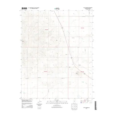
2013 Map of Little Grande
USGS Topo · Published 2013About this map
The high plains of Union County are anchored by the prominent rise of Sierra Grande, a massive volcanic feature that dominates the western portion of this landscape. In the shadow of this peak, the small settlements of Grande and Little Grande sit near the transition between the mountain slopes and the wide drainage basins of the northeast. The area is defined by its drainage networks, including the upper reaches of N Br Corrumpa Cr, S Br Corrumpa Cr, and Seneca Cr.
Find a feature on this map
23 named features on this map. Tap any name to fly to it.
Don’t see what you’re looking for? This feature index may not catch every label — zoom into the map to look around manually.
Map Details
Editions of this 2013 Little Grande Map
This is the sole edition of this map. No revisions or reprints were ever made.
Other maps of this area

1954 · Dalhart
USGS Topo · 1:250,000

1958 · Dalhart
USGS Topo · 1:250,000

1962 · Dalhart
USGS Topo · 1:250,000

1972 · Little Grande
USGS Topo · 1:24,000

1972 · Cross L Ranch SW
USGS Topo · 1:24,000
1972 · Des Moines
USGS Topo · 1:24,000

1972 · Capulin
USGS Topo · 1:24,000
1972 · Folsom
USGS Topo · 1:24,000

1972 · Malpie Mountain
USGS Topo · 1:24,000

1972 · Cow Mountain
USGS Topo · 1:24,000