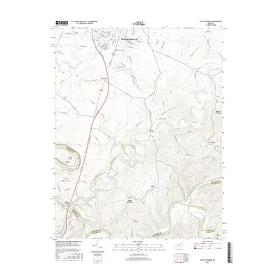
2016 Map of Little Hickman
USGS Topo · Published 2016About this map
Nicholasville marks the northern extent of this landscape, where suburban expansion meets the deeply incised drainages of central Kentucky. South of the city, the terrain is defined by the winding course of Hickman Creek and its many tributaries, which carve through the limestone toward the Kentucky River. Small agricultural hubs like Little Hickman, Hanly, and Pink are connected by a network of rural roads such as Pollard Pike and Watts Mill Rd.
Find a feature on this map
103 named features on this map. Tap any name to fly to it.
Don’t see what you’re looking for? This feature index may not catch every label — zoom into the map to look around manually.
Map Details
Editions of this 2016 Little Hickman Map
This is the sole edition of this map. No revisions or reprints were ever made.
Other maps of this area

1892 · Richmond
USGS Topo · 1:125,000

1897 · Richmond
USGS Topo · 1:125,000

1905 · Harrodsburg
USGS Topo · 1:125,000

1950 · Bryantsville
USGS Topo · 1:24,000

1952 · Keene
USGS Topo · 1:24,000

1952 · Valley View
USGS Topo · 1:24,000

1952 · Little Hickman
USGS Topo · 1:24,000

1952 · Nicholasville
USGS Topo · 1:24,000

1952 · Buckeye
USGS Topo · 1:24,000

1952 · Coletown
USGS Topo · 1:24,000