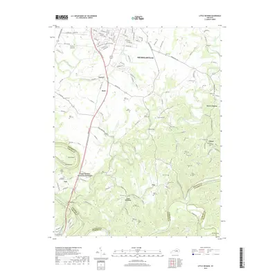
2019 Map of Little Hickman
USGS Topo · Published 2019About this map
Camp Nelson National Cemetery serves as a prominent landmark on this 2019 survey, situated near the dramatic bend of the Kentucky River where Jessamine and Garrard counties meet. This area of central Kentucky is defined by its deep river gorges and high points like Boones Knob and Chimney Rock. The landscape is densely populated with family burial grounds, such as the Miller Family Cem and Baker Farm Cem, reflecting generations of private land ownership. Smaller rural settlements including Little Hickman, Pollard, and Pink are connected by a network of historic routes like Sulphur Well Pike and Chrisman Mill Rd. The map tracks the winding course of Hickman Creek as it approaches the river, showing a transition from the developing edges of Nicholasville to the deeply dissected terrain of Pollys Bend.
Find a feature on this map
151 named features on this map. Tap any name to fly to it.
Don’t see what you’re looking for? This feature index may not catch every label — zoom into the map to look around manually.
Map Details
Editions of this 2019 Little Hickman Map
This is the sole edition of this map. No revisions or reprints were ever made.
Other maps of this area

1892 · Richmond
USGS Topo · 1:125,000

1897 · Richmond
USGS Topo · 1:125,000

1905 · Harrodsburg
USGS Topo · 1:125,000

1950 · Bryantsville
USGS Topo · 1:24,000

1952 · Keene
USGS Topo · 1:24,000

1952 · Valley View
USGS Topo · 1:24,000

1952 · Little Hickman
USGS Topo · 1:24,000

1952 · Nicholasville
USGS Topo · 1:24,000

1952 · Buckeye
USGS Topo · 1:24,000

1952 · Coletown
USGS Topo · 1:24,000