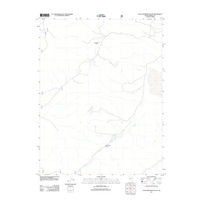
2011 Map of Little Huntoon Valley
USGS Topo · Published 2011About this map
Little Huntoon Valley dominates this high-altitude corner of Mineral County, Nevada, defined by its complex drainage systems and isolated canyons. This 2011 survey illustrates the hydrological network of Jacks Creek, which flows through the southwestern portion of the quadrangle, winding through the sharp topographic relief of Jacks Spring Canyon. The map reveals a high-desert landscape maintained by a sparse grid of forest service routes, including 200a, 178, and 862, which provide the primary access for land management and recreation in this unpopulated basin. The reliance on these primitive roads suggests a territory primarily utilized for grazing, mining exploration, or transit through the Great Basin's basin-and-range province.
Find a feature on this map
7 named features on this map. Tap any name to fly to it.
Don’t see what you’re looking for? This feature index may not catch every label — zoom into the map to look around manually.
Map Details
Editions of this 2011 Little Huntoon Valley Map
This is the sole edition of this map. No revisions or reprints were ever made.
Other maps of this area

1909 · Hawthorne
USGS Topo · 1:250,000

1911 · Hawthorne
USGS Topo · 1:250,000

1915 · Hawthorne
USGS Topo · 1:250,000

1948 · Walker Lake
USGS Topo · 1:250,000

1955 · Powell Mtn
USGS Topo · 1:62,500

1957 · Walker Lake
USGS Topo · 1:250,000

1958 · Huntoon Valley
USGS Topo · 1:62,500

1962 · Walker Lake
USGS Topo · 1:250,000

1964 · Walker Lake
USGS Topo · 1:250,000

1967 · Moho Mountain
USGS Topo · 1:24,000