
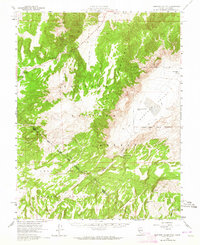
1958 Map of Huntoon Valley
USGS Topo · Published 1959About this map
Petroglyphs near Huntoon Spring mark the ancient human presence in this high-desert basin along the Nevada-California border. This late-1950s survey captures the high-altitude landscape of the Toiyabe National Forest and Inyo National Forest, where the complex Von Schmidt Line and various forest boundaries intersect. The map documents a sparsely settled region defined by its water sources, including Government Well and the dry Granite Spring.
Find a feature on this map
30 named features on this map. Tap any name to fly to it.
Don’t see what you’re looking for? This feature index may not catch every label — zoom into the map to look around manually.
Map Details
Editions of this 1958 Huntoon Valley Map
3 editions found
Other maps of this area

1909 · Hawthorne
USGS Topo · 1:250,000

1911 · Hawthorne
USGS Topo · 1:250,000

1914 · Mt. Morrison
USGS Topo · 1:125,000

1915 · Hawthorne
USGS Topo · 1:250,000

1917 · White Mountain
USGS Topo · 1:125,000

1947 · Mariposa
USGS Topo · 1:250,000

1948 · Walker Lake
USGS Topo · 1:250,000

1948 · Mariposa
USGS Topo · 1:250,000

1955 · Powell Mtn
USGS Topo · 1:62,500

1956 · Aurora
USGS Topo · 1:62,500