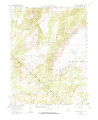
1958 Map of Huntoon Valley
USGS Topo · Published 1964About this map
The Excelsior Mountains and Anchorite Hills dominate this high-desert landscape along the border of Nevada and California. Published in the early 1960s from late 1950s field data, the survey highlights a region defined by remote outposts and ancient markings, most notably the Petroglyphs found near Huntoon Spring. The map documents the sparse human footprint in this arid terrain, marking small settlements like Eaton and Cow Camp, alongside several water sources essential for survival and industry, such as Government Well and Whisky Flat.
Find a feature on this map
25 named features on this map. Tap any name to fly to it.
Don’t see what you’re looking for? This feature index may not catch every label — zoom into the map to look around manually.
Map Details
Editions of this 1958 Huntoon Valley Map
3 editions found

Other maps of this area

1909 · Hawthorne
USGS Topo · 1:250,000

1911 · Hawthorne
USGS Topo · 1:250,000

1914 · Mt. Morrison
USGS Topo · 1:125,000

1915 · Hawthorne
USGS Topo · 1:250,000

1917 · White Mountain
USGS Topo · 1:125,000

1947 · Mariposa
USGS Topo · 1:250,000

1948 · Walker Lake
USGS Topo · 1:250,000

1948 · Mariposa
USGS Topo · 1:250,000

1955 · Powell Mtn
USGS Topo · 1:62,500

1956 · Aurora
USGS Topo · 1:62,500