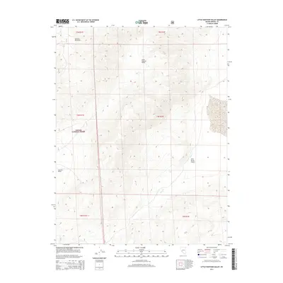
2014 Map of Little Huntoon Valley
USGS Topo · Published 2014About this map
Little Huntoon Valley and the neighboring Huntoon Valley occupy a high-elevation desert landscape defined by the drainage patterns of the Excelsior Mountains. This Mineral County region is largely preserved within the Toiyabe National Forest, where steep, arid slopes converge at Jacks Spring Canyon. The map details the intricate topography of the basin-and-range geography, highlighting the importance of seasonal water sources such as Jacks Cr. These drainages were critical for early grazing and mineral exploration in the remote Nevada interior during the late twentieth century. Surveying lines for townships and ranges, including t5n r31e, mark the jurisdictional grid across this sparsely populated wilderness, providing a clear record of the public land system used by federal agencies to manage these high-desert territories.
Find a feature on this map
12 named features on this map. Tap any name to fly to it.
Don’t see what you’re looking for? This feature index may not catch every label — zoom into the map to look around manually.
Map Details
Editions of this 2014 Little Huntoon Valley Map
This is the sole edition of this map. No revisions or reprints were ever made.
Other maps of this area

1909 · Hawthorne
USGS Topo · 1:250,000

1911 · Hawthorne
USGS Topo · 1:250,000

1915 · Hawthorne
USGS Topo · 1:250,000

1948 · Walker Lake
USGS Topo · 1:250,000

1955 · Powell Mtn
USGS Topo · 1:62,500

1957 · Walker Lake
USGS Topo · 1:250,000

1958 · Huntoon Valley
USGS Topo · 1:62,500

1962 · Walker Lake
USGS Topo · 1:250,000

1964 · Walker Lake
USGS Topo · 1:250,000

1967 · Moho Mountain
USGS Topo · 1:24,000