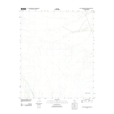
2012 Map of Little Maria Mountains
USGS Topo · Published 2012About this map
The Little Maria Mountains rise across the arid terrain of Riverside County in this 2012 survey, revealing a landscape defined by dramatic elevation shifts and desert washes. The geography is marked by a network of drainage patterns flowing from the mountain slopes toward the flat basins below. Access through this portion of the Mojave is limited to a few arterial routes, including the prominent Midland Rd which cuts through the northeastern corner and the southwest-trending Coxcomb Monument Rd. The map illustrates the stark physical transition between the rocky peaks and the alluvial fans that spread across the valley floor, providing a detailed look at the topographic contours of this uninhabited mountain range during the early 21st century.
Find a feature on this map
3 named features on this map. Tap any name to fly to it.
Don’t see what you’re looking for? This feature index may not catch every label — zoom into the map to look around manually.
Map Details
Editions of this 2012 Little Maria Mountains Map
This is the sole edition of this map. No revisions or reprints were ever made.
Other maps of this area

1942 · Blythe
USGS Topo · 1:250,000

1942 · Amboy
USGS Topo · 1:250,000

1943 · Amboy
USGS Topo · 1:250,000

1943 · Iron Mountains
USGS Topo · 1:62,500

1945 · Midland
USGS Topo · 1:62,500

1952 · Midland
USGS Topo · 1:62,500

1952 · Palen Mountains
USGS Topo · 1:62,500

1954 · Salton Sea
USGS Topo · 1:250,000

1954 · Needles
USGS Topo · 1:250,000

1954 · Rice
USGS Topo · 1:62,500