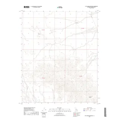
2018 Map of Little Maria Mountains
USGS Topo · Published 2018About this map
The Little Maria Mountains dominate the southern half of this Riverside County landscape, rising sharply from the surrounding desert floor. This 2018 survey details a rugged, arid environment characterized by significant topographic relief and ephemeral water sources such as Tank Spring. To the north, the terrain transitions into the broad expanse of Rice Valley, where the land levelness is interrupted only by the seasonal drainage of Sand Draw. Remote access to this interior desert region is maintained via unpaved routes like Palen Pass Rd in the southwest and Midland Rd in the northeast, reflecting the area's isolation and its primary role as a wilderness and resource management zone under the Bureau of Land Management.
Find a feature on this map
10 named features on this map. Tap any name to fly to it.
Don’t see what you’re looking for? This feature index may not catch every label — zoom into the map to look around manually.
Map Details
Editions of this 2018 Little Maria Mountains Map
This is the sole edition of this map. No revisions or reprints were ever made.
Other maps of this area

1942 · Blythe
USGS Topo · 1:250,000

1942 · Amboy
USGS Topo · 1:250,000

1943 · Amboy
USGS Topo · 1:250,000

1943 · Iron Mountains
USGS Topo · 1:62,500

1945 · Midland
USGS Topo · 1:62,500

1952 · Midland
USGS Topo · 1:62,500

1952 · Palen Mountains
USGS Topo · 1:62,500

1954 · Salton Sea
USGS Topo · 1:250,000

1954 · Needles
USGS Topo · 1:250,000

1954 · Rice
USGS Topo · 1:62,500