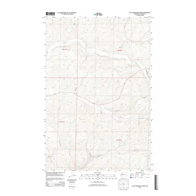
2013 Map of Little Penawawa Creek
USGS Topo · Published 2013About this map
Union Flat Cr and Alkali Flat Cr wind through the dry, rolling landscape of Whitman County, defining a region where the geography is etched by seasonal watercourses. The local social fabric centers on the Wilcox Grange, a notable landmark along Wilcox Rd in the southeastern quadrant. This area of the Palouse is primarily agricultural, evidenced by the extensive network of rural roads such as Helen Repp Rd, Musgrave Rd, and Penawawa Rd that navigate the ridges and coulees. Smaller drainages including Frog Cr and Little Penawawa Cr feed into the larger creek systems, while Wa-26 serves as the primary east-west arterial connecting the isolated homesteads and farmsteads within the surveyed townships of T15N and T16N.
Find a feature on this map
25 named features on this map. Tap any name to fly to it.
Don’t see what you’re looking for? This feature index may not catch every label — zoom into the map to look around manually.
Map Details
Editions of this 2013 Little Penawawa Creek Map
This is the sole edition of this map. No revisions or reprints were ever made.
Other maps of this area

1910 · Pullman
USGS Topo · 1:125,000

1950 · Penawawa
USGS Topo · 1:62,500

1950 · Endicott
USGS Topo · 1:62,500

1955 · Pullman
USGS Topo · 1:250,000

1958 · Pullman
USGS Topo · 1:250,000

1964 · Diamond
USGS Topo · 1:24,000

1964 · Wilcox
USGS Topo · 1:24,000
1964 · Almota
USGS Topo · 1:24,000

1981 · Dusty
USGS Topo · 1:24,000
1981 · Ping
USGS Topo · 1:24,000