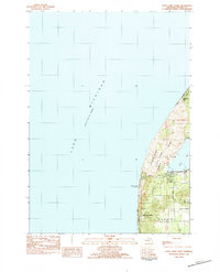
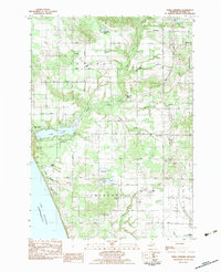
1983 Map of Little Point Sable
USGS Topo · Published 1983About this map
Little Point Sable Lighthouse stands as the primary landmark on this stretch of the Lake Michigan shoreline, marking the prominent coastal projection within Golden township. The landscape is defined by the massive dunes of Silver Lake State Park, which separate the open waters of Lake Michigan from the inland Silver Lake. This 1983 provisional survey shows a coastal environment shaped by moving sands and water, with Richmonds Inlet to the north and the small settlement of Little Point Sable clustered near the lighthouse. Further inland, the map transitions into the rural grid of Benona township, where local routes like 18th Avenue and Warren Road provide access to the farms and woodlots situated behind the coastal dune system.
Find a feature on this map
13 named features on this map. Tap any name to fly to it.
Don’t see what you’re looking for? This feature index may not catch every label — zoom into the map to look around manually.
Map Details
Editions of this 1983 Little Point Sable Map
This is the sole edition of this map. No revisions or reprints were ever made.
Other maps of this area

1931 · Hart NW
USGS Topo · 1:31,680

1932 · Ludington SW
USGS Topo · 1:31,680

1954 · Milwaukee
USGS Topo · 1:250,000

1958 · Milwaukee
USGS Topo · 1:250,000

1959 · Ludington
USGS Topo · 1:62,500

1959 · Hart
USGS Topo · 1:62,500
1976 · Hart NW
USGS Topo · 1:24,000
1983 · Mears
USGS Topo · 1:25,000
1983 · Bigsbie Lake
USGS Topo · 1:24,000
1983 · Town Corners
USGS Topo · 1:25,000