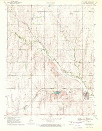
1970 Map of Little River
USGS Topo · Published 1972About this map
The town of Little River serves as the hub of this Kansas landscape, where the Atchison Topeka and Santa Fe railroad tracks cut a diagonal path across the prairie. The settlement pattern here is closely tied to the water and rail network, with the village of Mitchell and the small cluster at Galt established along the transportation corridor. Near Galt, a Townhall and a Quarry mark the localized infrastructure of the era.
Find a feature on this map
20 named features on this map. Tap any name to fly to it.
Don’t see what you’re looking for? This feature index may not catch every label — zoom into the map to look around manually.
Map Details
Editions of this 1970 Little River Map
2 editions found
Other maps of this area

1891 · Hutchinson
USGS Topo · 1:125,000

1892 · Salina
USGS Topo · 1:125,000

1893 · Hutchinson
USGS Topo · 1:125,000

1894 · Ellsworth
USGS Topo · 1:125,000

1894 · Lyons
USGS Topo · 1:125,000

1942 · Salina
USGS Topo · 1:125,000

1955 · Great Bend
USGS Topo · 1:250,000

1955 · Hutchinson
USGS Topo · 1:250,000

1957 · Great Bend
USGS Topo · 1:250,000

1958 · Great Bend
USGS Topo · 1:250,000