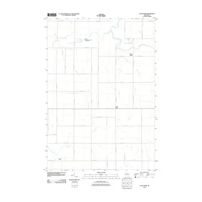
2010 Map of Little Rose
USGS Topo · Published 2010About this map
March Rapids and Little Rose anchor this central Wisconsin landscape, where the drainage of the Big Eau Pleine River and the Little Eau Pleine River defines the local topography. This 2010 survey shows a region marked by agricultural grid roads and small-scale water management, evidenced by the Del Fatti Construction Number 1 G-8737 Dam on Dill Creek and the Kopp G 26 Dam further south. The map provides a clear look at the rural intersection of Marathon County infrastructure, from the diagonal path of Noisy Creek to the established routes of County Hwy-P and County Hwy-E. The detailed labeling of tributaries like Carlson Creek and Raeder Creek makes this an essential document for understanding the hydrology and land divisions of the McMillan area in the early 21st century.
Find a feature on this map
39 named features on this map. Tap any name to fly to it.
Don’t see what you’re looking for? This feature index may not catch every label — zoom into the map to look around manually.
Map Details
Editions of this 2010 Little Rose Map
This is the sole edition of this map. No revisions or reprints were ever made.
Other maps of this area

1902 · Marathon
USGS Topo · 1:125,000

1953 · Abbotsford
USGS Topo · 1:48,000

1953 · Stratford
USGS Topo · 1:48,000

1953 · Eau Claire
USGS Topo · 1:250,000

1954 · Granton
USGS Topo · 1:62,500

1954 · Marshfield
USGS Topo · 1:62,500

1958 · Eau Claire
USGS Topo · 1:250,000

1963 · Stratford
USGS Topo · 1:62,500

1963 · Abbotsford
USGS Topo · 1:62,500

1964 · Eau Claire
USGS Topo · 1:250,000