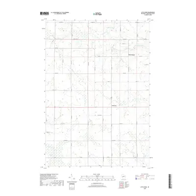
2018 Map of Little Rose
USGS Topo · Published 2018About this map
March Rapids and Little Rose anchor this Marathon County landscape, where the agricultural grid meets the drainage networks of central Wisconsin. The topography is defined by the winding course of the Big Eau Pleine River in the north and the expansive McMillan Marsh in the south, a significant wetland complex that shapes the local road patterns. Numerous tributaries, including Dill Creek, Kuehni Cr, and Carlson Cr, carve through the terrain between established corridors like Co Rd P and Co Rd E. The map reveals a rural transition where the managed forest and marshlands of the McMillan Marsh interface with the small-scale settlements and homesteads that define this region. This survey captures the modern alignment of historic county routes and local names such as March Rapids Ave and Wescott Ave in a landscape still fundamentally tied to its river-and-marsh geography.
Find a feature on this map
43 named features on this map. Tap any name to fly to it.
Don’t see what you’re looking for? This feature index may not catch every label — zoom into the map to look around manually.
Map Details
Editions of this 2018 Little Rose Map
This is the sole edition of this map. No revisions or reprints were ever made.
Other maps of this area

1902 · Marathon
USGS Topo · 1:125,000

1953 · Abbotsford
USGS Topo · 1:48,000

1953 · Stratford
USGS Topo · 1:48,000

1953 · Eau Claire
USGS Topo · 1:250,000

1954 · Granton
USGS Topo · 1:62,500

1954 · Marshfield
USGS Topo · 1:62,500

1958 · Eau Claire
USGS Topo · 1:250,000

1963 · Stratford
USGS Topo · 1:62,500

1963 · Abbotsford
USGS Topo · 1:62,500

1964 · Eau Claire
USGS Topo · 1:250,000