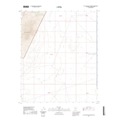
2023 Map of Little San Pascual Mountain
USGS Topo · Published 2023About this map
Little San Pascual Wilderness and the Bosque Del Apache National Wildlife Refuge converge in this high-desert landscape within Socorro County. The terrain is defined by the prominent Little San Pascual Mountain, which rises above a series of arid flats and ephemeral water features like Shorty Tank. This contemporary 2023 survey illustrates the overlap of conservation lands and federal restricted zones, as the eastern portion of the quadrangle falls within the White Sands Missile Range. The map provides a precise look at the township and range boundaries that organize this remote stretch of New Mexico, highlighting how modern wildlife protection areas and military installations share the same geography.
Find a feature on this map
11 named features on this map. Tap any name to fly to it.
Don’t see what you’re looking for? This feature index may not catch every label — zoom into the map to look around manually.
Map Details
Editions of this 2023 Little San Pascual Mountain Map
This is the sole edition of this map. No revisions or reprints were ever made.
Other maps of this area

1948 · Carthage
USGS Topo · 1:62,500

1948 · Granjean Well
USGS Topo · 1:62,500

1948 · San Antonio
USGS Topo · 1:62,500

1948 · Val Verde
USGS Topo · 1:62,500

1954 · Tularosa
USGS Topo · 1:250,000

1958 · Tularosa
USGS Topo · 1:250,000

1981 · Granjean Well
USGS Topo · 1:24,000
1981 · Blakemore Well
USGS Topo · 1:24,000
1981 · Indian Well Wilderness
USGS Topo · 1:24,000

1981 · Harriet Ranch
USGS Topo · 1:24,000